Building and construction
The point cloud data is used to automatically detect and measure the size of the bridge main girder section. The laser scanner improves the efficiency of construction management.
Relying on the three-dimensional laser scanner to measure the cross-section of the concrete bridge under construction, a set of “automatic inspection system for as-built structure” that calculates the size of the bridge based on point cloud data has been developed. With this system, the time required to measure a cross-section is significantly reduced by nearly half compared to the original.
Bridges are generally 3~5m in length as a block, and are erected while pouring concrete in the air using a movable forming frame. Since the thickness of the bridge will gradually become thinner as it moves away from the pier, it is very important to perform “forming management” measurements on a block basis to ensure that the geometry of each cross-section conforms to the design.
According to reports, the previous mainstream measurement method consisted of a five-person team consisting of two surveyors, a photographer, a recording staff, and an inspector, and measuring the size of each part with a tape measure.
Using this method, each cross section takes about 45 minutes. The use of the newly developed system reduces the on-site measurement time for each cross-section to 20 minutes.”
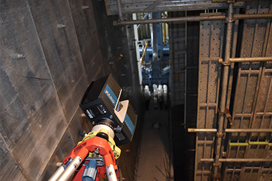
The cross-section of the bridge must be measured after the poured concrete has hardened, and the forming frame must be removed. The laser scanner is installed in the four positions on the left, up and down, and on the right, up and down in sequence in front of the bridge to perform point cloud measurement on the cross-section of the bridge modules. However, problems were encountered when actually measuring the two points above and left. If a tripod was used, the bottom of the bridge would become a “dead spot” that could not be measured.
“So, we thought of a method of measuring the laser scanner by turning it 90° laterally. The lateral measurement was successfully achieved by turning off the gravity sensor.” This method of use can only be achieved with a small and lightweight laser scanner.
Set up “target balls” in multiple places around the bridge and use them as reference points to synthesize point cloud data measured at 4 locations into unified data. In order to scan from the best angle, the laser scanner is installed horizontally on the overhead beam. Although the surveyor has no foothold at this time, he can still perform remote and safe operations through the tablet computer.


